
Above-normal cold wave days are expected in some areas of central India, eastern Uttar Pradesh and Bihar during January 2026.

The India Meteorological Department (IMD) forecasts above-normal rainfall for India in September, following a monsoon season marked by heavy downpours and related disasters in various regions. The forecast indicates normal to above-normal rainfall for most areas, with some exceptions in the northeast, east, extreme south peninsular India, and parts of northwest India.

A new western disturbance brought thunderstorms and rain to parts of northern India, with hailstorms and snow reported in several regions. The weather caused flooding in Jammu and Kashmir and prompted a yellow alert in Delhi.

The India Meteorological Department (IMD) reports that ash clouds from volcanic activity in Ethiopia, which impacted flight operations in India, are drifting towards China and will move away from India by 7.30 pm on Tuesday.

The last time the southwest monsoon arrived earlier than in 2025 -- that is, back in 2009 -- the rains lost steam after the early onset and ended the season with almost 23 per cent deficient rainfall, which was the lowest recorded average rainfall in several decades over India.

Delhi recorded its coldest January morning in three years with the minimum temperature dropping to 3 degrees Celsius. Cold wave conditions are expected to persist, and air quality has deteriorated to the 'very poor' category.

The civil aviation ministry is monitoring the impact of volcanic ash plumes from Ethiopia on flight operations, leading to cancellations and delays. The situation is being closely monitored, and necessary precautions are being taken.

The national capital was in the grip of a cold wave, with the sun largely obscured by clouds and pollutants lingering in the atmosphere, leading to reduced visibility. At least 129 flights were cancelled at the Delhi airport on Saturday due to dense fog, according to an official.

The IMD has fancy weather-monitoring radars in the name of providing better forecasts.

The India Meteorological Department (IMD) has predicted above-normal rainfall for the upcoming monsoon season in India (June to September). The cumulative rainfall is estimated to be 105 percent of the long-period average. The IMD has also ruled out the possibility of El Nino conditions during the entire season. The monsoon is crucial for India's agriculture sector, which supports the livelihood of a significant portion of the population and contributes substantially to the country's GDP. However, while the prediction of normal rainfall brings relief, climate change is expected to cause variations in rainfall distribution.

With rainfall and monsoons becoming highly unpredictable partly due to climate change and partly due to usual changes in weather patterns, it is such innovations by IMD which will help in planning better, reports Sanjeeb Mukherjee.

IMD has decided to increasingly use cutting-edge technology such as artificial intelligence (AI) and machine learning (ML) in forecasting, both to avoid such glitches and to counter the disruption of normal seasonal patterns as a result of climate change. It has formed various internal sub-groups of senior officials and meteorologists to decide on how best to use AI and ML in predicting cyclone intensity, and in making short-range weather forecasts (those valid for up to three hours) as well as long-range forecasts.

A thick layer of toxic smog enveloped the national capital on Saturday as air quality deteriorated sharply, prompting the Commission for Air Quality Management (CAQM) to invoke the strictest curbs under Stage IV of the Graded Response Action Plan (GRAP) across Delhi-NCR.

The India Meteorological Department (IMD) has issued a 'red alert', warning of extremely heavy rainfall in Mumbai, Thane, Raigad and Palghar districts on Sunday, extending the wet patch in the region.

On the weather front, dense fog led to a sharp drop in visibility, with Palam recording 50 metres visibility under dense fog conditions with west-southwesterly winds at 5 kmph at 8 am, while Safdarjung reported 100 metres visibility with calm winds at the same time.

India's crucial monsoon will be normal this year but with less heavier rains as the weather office on Friday marginally downgraded its earlier forecast.

The drought of 2009 still haunts the India Meteorological Department.

Dense fog disrupted operations at Delhi airport, leading to cancellations and delays of hundreds of flights. Airlines are offering refunds and rescheduling options.
Skymet lowered its full season monsoon forecast to 'below normal' from 'normal', while the IMD is sticking to its earlier forecast that rains in June to September of 2018 would be 'normal' at 97 per cent of the LPA with a model error of +/-5 per cent.
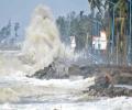
Cyclone Ditwah is moving towards the Tamil Nadu coast, bringing the threat of heavy rainfall. The state government is reviewing preparedness measures, and a red alert has been issued for southern and delta districts.

Delhi choked under a thick blanket of smog on Monday, with the Air Quality Index (AQI) settling at 498, which falls in the higher spectrum of 'severe' category.

Bhavnagar was also one of the worst affected districts, they said, adding that more downpour is likely over the next four day in parts of the state.

The record monsoon rains across India during the June to September months was 937.2 millimetres, the 5th-highest since 2001 and 38th-highest since 1901.
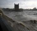
The wind speed, reaching 45-55 kmph and gusting to 65 kmph, is likely to prevail over the North Maharashtra coast between October 3 and 5.

Heatwave may abate over most parts of North India in next two days; temperatures likely to drop by 2-3C.

The India Meteorological Department (IMD) on Monday issued a warning of significant rainfall in Kerala due to cyclone Fengal, currently positioned as a strong low-pressure area over northern Tamil Nadu.

Climate change has hampered the ability of the forecasting agencies to accurately predict severe events and weather bureaus across the world are focusing on augmenting the observational network density and the weather prediction modelling to improve predictability, India Meteorological Department (IMD) Director General Mrutyunjay Mohapatra has said.

A severe cold wave has gripped North India, with temperatures plummeting to near-freezing levels in several areas. The cold wave has disrupted daily life, with dense fog affecting visibility and forcing people to stay indoors.

While the IMD had forecast a 'normal' monsoon for the entire season, Skymet stated that rain this year would be 'below normal', report Sanjeeb Mukherjee and Sahil Makkar.

Various parts of Surat were flooded after incessant rainfall in the region. Over 100 mm of rain has blocked roads and led to waterlogging in several low-lying areas.

Some India states are likely to record a significantly higher number of heatwave days, according to the national weather body.

Heavy rains lashed Mumbai, slowing traffic and affecting train services. The IMD has issued an 'Orange' alert, advising citizens to stay indoors.

According to weather officials, wind speeds along and off the Odisha-West Bengal coasts are anticipated to reach 60 km/h from October 23, increasing to 120 km/h from October 24 night to October 25 morning.

Historically, October has seen some of the worst landslide events in Darjeeling and Sikkim Himalayas.

Lightning claims more lives in India annually than any other extreme weather event. Between April and July this year alone, 1,621 people died due to lightning strikes.

Several parts of Mumbai received heavy rainfall in the last 24 hours, with Vikhroli reporting the highest downpour. The IMD reported significant rainfall in various areas of the city.

Heavy rains continue to batter Tamil Nadu, causing a rise in reservoir levels and prompting a red alert. Schools and colleges are closed in several districts as authorities prepare for potential flooding.

The official India Meteorological Department (IMD) and the private Skymet Weather Services have made widely divergent monsoon forecasts.

Trading sentiment in the equity market will largely be driven by domestic corporate quarterly earnings, any update related to US tariffs and foreign fund movements this week, analysts said. Investors would also focus on world market trends, movement of global oil benchmark Brent crude and the rupee-dollar trend for further cues, experts noted.

This would be the second cyclonic storm in the Arabian Sea this year.
